


pujaudran fait 2024

pidjam
User
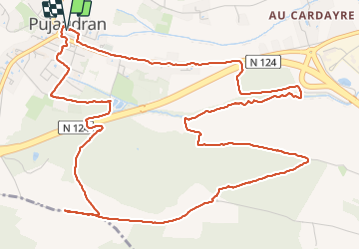

Length
8.5 km

Max alt
305 m

Uphill gradient
156 m
Km-Effort
10.6 km

Min alt
231 m

Downhill gradient
155 m
Boucle
Yes
Creation date :
2024-01-11 13:32:19.248
Updated on :
2024-01-11 15:42:15.693
2h00
Difficulty : Easy

FREE GPS app for hiking
 SityTrail
IGN / Geographical institutes
SityTrail Plus
The world is yours!
About
Trail Walking of 8.5 km to be discovered at Occitania, Gers, Pujaudran. This trail is proposed by pidjam.
Positioning
Country:
France
Region :
Occitania
Department/Province :
Gers
Municipality :
Pujaudran
Location:
Unknown
Start:(Dec)
Start:(UTM)
350661 ; 4828147 (31T) N.
Comments