


Trace Bagneres G3 Guy

mitch1952
User
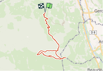

Length
9.9 km

Max alt
1253 m

Uphill gradient
561 m
Km-Effort
17.4 km

Min alt
763 m

Downhill gradient
561 m
Boucle
Yes
Creation date :
2024-01-12 08:30:15.0
Updated on :
2024-01-12 14:35:40.308

FREE GPS app for hiking
 SityTrail
IGN / Geographical institutes
SityTrail Plus
The world is yours!
About
Trail of 9.9 km to be discovered at Occitania, Hautespyrenees, Bagnères-de-Bigorre. This trail is proposed by mitch1952.
Positioning
Country:
France
Region :
Occitania
Department/Province :
Hautespyrenees
Municipality :
Bagnères-de-Bigorre
Location:
Unknown
Start:(Dec)
Start:(UTM)
266671 ; 4770882 (31T) N.
Comments