


Le télégraphe de Chappe-12-01-2024

Christiancordin
User
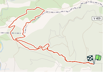

Length
8 km

Max alt
422 m

Uphill gradient
317 m
Km-Effort
12.2 km

Min alt
114 m

Downhill gradient
315 m
Boucle
Yes
Creation date :
2024-01-12 13:04:18.718
Updated on :
2024-01-20 18:09:42.888
2h22
Difficulty : Medium

FREE GPS app for hiking
 SityTrail
IGN / Geographical institutes
SityTrail Plus
The world is yours!
About
Trail Walking of 8 km to be discovered at Provence-Alpes-Côte d'Azur, Var, Ollioules. This trail is proposed by Christiancordin.
Description
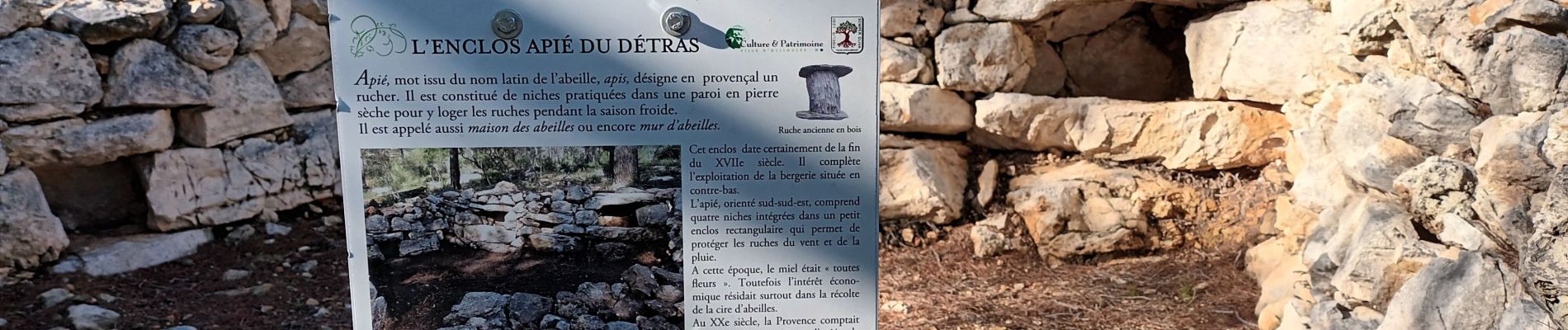
PK de Châteauvallon, le Détras, l'apié, col du Télégraphe, GR51, Capeu Gros, limite de commune, télégraphe de Chappe.
Photos


Positioning
Country:
France
Region :
Provence-Alpes-Côte d'Azur
Department/Province :
Var
Municipality :
Ollioules
Location:
Unknown
Start:(Dec)
Start:(UTM)
733919 ; 4781143 (31T) N.
Comments