


parking villars heyssier congerman

clintest
User
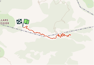

Length
9.3 km

Max alt
1881 m

Uphill gradient
684 m
Km-Effort
18.4 km

Min alt
1300 m

Downhill gradient
685 m
Boucle
Yes
Creation date :
2024-01-12 16:52:29.642
Updated on :
2024-01-12 16:53:06.99
4h10
Difficulty : Difficult

FREE GPS app for hiking
 SityTrail
IGN / Geographical institutes
SityTrail Plus
The world is yours!
About
Trail Walking of 9.3 km to be discovered at Provence-Alpes-Côte d'Azur, Alpes-de-Haute-Provence, Beauvezer. This trail is proposed by clintest.
Positioning
Country:
France
Region :
Provence-Alpes-Côte d'Azur
Department/Province :
Alpes-de-Haute-Provence
Municipality :
Beauvezer
Location:
Unknown
Start:(Dec)
Start:(UTM)
309025 ; 4888576 (32T) N.
Comments