


heyssier cabane de congerman baisse orgeas ondres

clintest
User
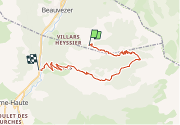

Length
14.8 km

Max alt
2013 m

Uphill gradient
770 m
Km-Effort
26 km

Min alt
1095 m

Downhill gradient
984 m
Boucle
No
Creation date :
2024-01-12 16:58:50.961
Updated on :
2024-01-12 16:59:44.09
5h52
Difficulty : Very difficult

FREE GPS app for hiking
 SityTrail
IGN / Geographical institutes
SityTrail Plus
The world is yours!
About
Trail Walking of 14.8 km to be discovered at Provence-Alpes-Côte d'Azur, Alpes-de-Haute-Provence, Beauvezer. This trail is proposed by clintest.
Positioning
Country:
France
Region :
Provence-Alpes-Côte d'Azur
Department/Province :
Alpes-de-Haute-Provence
Municipality :
Beauvezer
Location:
Unknown
Start:(Dec)
Start:(UTM)
309077 ; 4888556 (32T) N.
Comments