


Laps_Coteaux_BR

jagarnier
User GUIDE
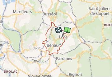

Length
9.6 km

Max alt
616 m

Uphill gradient
281 m
Km-Effort
13.4 km

Min alt
437 m

Downhill gradient
289 m
Boucle
Yes
Creation date :
2024-01-13 07:51:41.277
Updated on :
2025-03-23 11:30:36.482
2h45
Difficulty : Medium

FREE GPS app for hiking
 SityTrail
IGN / Geographical institutes
SityTrail Plus
The world is yours!
About
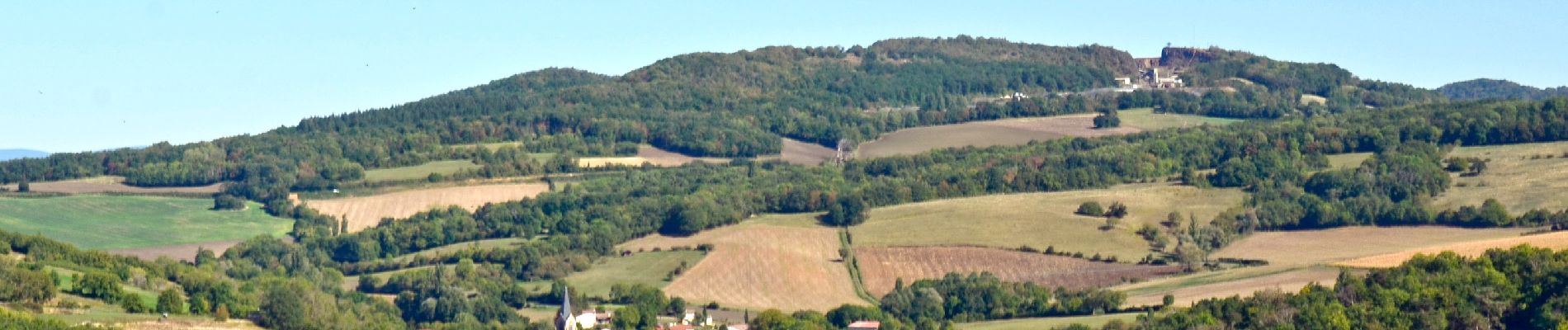
Trail Walking of 9.6 km to be discovered at Auvergne-Rhône-Alpes, Puy-de-Dôme, Laps. This trail is proposed by jagarnier.
Photos

Positioning
Country:
France
Region :
Auvergne-Rhône-Alpes
Department/Province :
Puy-de-Dôme
Municipality :
Laps
Location:
Unknown
Start:(Dec)
Start:(UTM)
520967 ; 5057867 (31T) N.
Comments
