


030124

mzonzon05
User
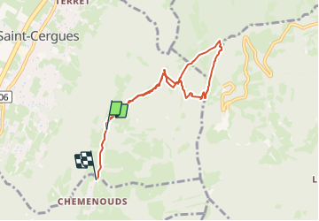

Length
7.3 km

Max alt
1479 m

Uphill gradient
497 m
Km-Effort
13.9 km

Min alt
960 m

Downhill gradient
513 m
Boucle
No
Creation date :
2024-01-03 09:36:32.184
Updated on :
2024-01-13 23:13:01.811
2h58
Difficulty : Difficult

FREE GPS app for hiking
 SityTrail
IGN / Geographical institutes
SityTrail Plus
The world is yours!
About
Trail Walking of 7.3 km to be discovered at Auvergne-Rhône-Alpes, Upper Savoy, Saint-Cergues. This trail is proposed by mzonzon05.
Description
jolie balade dans les Voirons à faire de tout temps et toute saison. Jolie vue sur le lac Léman.
Photos


Positioning
Country:
France
Region :
Auvergne-Rhône-Alpes
Department/Province :
Upper Savoy
Municipality :
Saint-Cergues
Location:
Unknown
Start:(Dec)
Start:(UTM)
294468 ; 5122287 (32T) N.
Comments