


SityTrail - 3910406 -

olivieraron
User
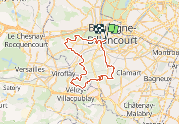

Length
29 km

Max alt
187 m

Uphill gradient
681 m
Km-Effort
38 km

Min alt
16 m

Downhill gradient
681 m
Boucle
Yes
Creation date :
2024-01-16 11:48:45.0
Updated on :
2024-01-16 11:48:46.912

FREE GPS app for hiking
 SityTrail
IGN / Geographical institutes
SityTrail Plus
The world is yours!
About
Trail of 29 km to be discovered at Ile-de-France, Hauts-de-Seine, Boulogne-Billancourt. This trail is proposed by olivieraron.
Positioning
Country:
France
Region :
Ile-de-France
Department/Province :
Hauts-de-Seine
Municipality :
Boulogne-Billancourt
Location:
Unknown
Start:(Dec)
Start:(UTM)
443638 ; 5408856 (31U) N.
Comments