


papillon de Cailhau

Mascart
User
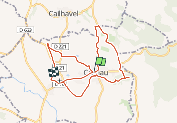

Length
10.5 km

Max alt
293 m

Uphill gradient
149 m
Km-Effort
12.6 km

Min alt
204 m

Downhill gradient
192 m
Boucle
No
Creation date :
2024-01-16 12:40:53.49
Updated on :
2024-01-16 17:04:46.507
3h00
Difficulty : Easy

FREE GPS app for hiking
 SityTrail
IGN / Geographical institutes
SityTrail Plus
The world is yours!
About
Trail Walking of 10.5 km to be discovered at Occitania, Aude, Cailhau. This trail is proposed by Mascart.
Description
boucle autour de Cailhau
Positioning
Country:
France
Region :
Occitania
Department/Province :
Aude
Municipality :
Cailhau
Location:
Unknown
Start:(Dec)
Start:(UTM)
429824 ; 4777468 (31T) N.
Comments