


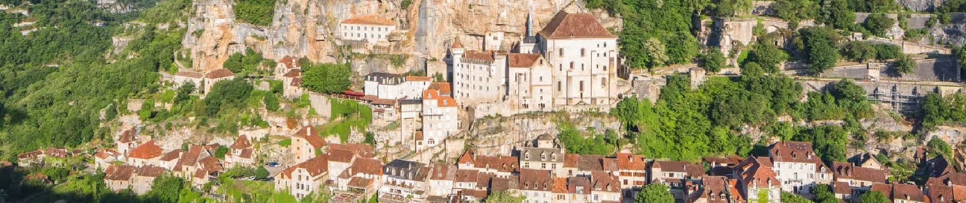
Rocamadour_2_Vallees

jagarnier
User GUIDE
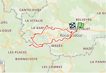

Length
16.6 km

Max alt
280 m

Uphill gradient
423 m
Km-Effort
22 km

Min alt
114 m

Downhill gradient
423 m
Boucle
Yes
Creation date :
2024-01-17 09:55:26.986
Updated on :
2024-05-03 09:25:12.532
5h15
Difficulty : Medium

FREE GPS app for hiking
 SityTrail
IGN / Geographical institutes
SityTrail Plus
The world is yours!
About
Trail Walking of 16.6 km to be discovered at Occitania, Lot, Rocamadour. This trail is proposed by jagarnier.
Photos

Positioning
Country:
France
Region :
Occitania
Department/Province :
Lot
Municipality :
Rocamadour
Location:
Unknown
Start:(Dec)
Start:(UTM)
391216 ; 4961898 (31T) N.
Comments