Albas 19/20

elexine23
User
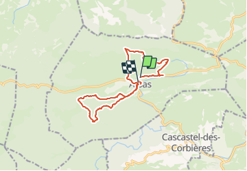

Length
16.1 km

Max alt
391 m

Uphill gradient
557 m
Km-Effort
24 km

Min alt
221 m

Downhill gradient
555 m
Boucle
Yes
Creation date :
2024-01-18 08:06:09.225
Updated on :
2024-01-18 15:51:58.774
7h34
Difficulty : Medium

FREE GPS app for hiking
 SityTrail
IGN / Geographical institutes
SityTrail Plus
The world is yours!
About
Trail Walking of 16.1 km to be discovered at Occitania, Aude, Albas. This trail is proposed by elexine23.
Positioning
Country:
France
Region :
Occitania
Department/Province :
Aude
Municipality :
Albas
Location:
Unknown
Start:(Dec)
Start:(UTM)
478398 ; 4761753 (31T) N.
Comments