


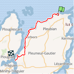
Le GR 34 entre les menhirs de Pleubian et Trédarzec (Ker an Trez)

ace003
User

Length
17.7 km

Max alt
68 m

Uphill gradient
224 m
Km-Effort
21 km

Min alt
-1 m

Downhill gradient
218 m
Boucle
No
Creation date :
2015-03-04 00:00:00.0
Updated on :
2015-03-04 00:00:00.0
3h45
Difficulty : Easy

FREE GPS app for hiking
 SityTrail
IGN / Geographical institutes
SityTrail Plus
The world is yours!
About
Trail Walking of 17.7 km to be discovered at Brittany, Côtes-d'Armor, Pleubian. This trail is proposed by ace003.
Description
Le 4 mars 2015
Photos
 - Photo 1")
 - Photo 2")
 - Photo 3")
 - Photo 4")
 - Photo 5")
 - Photo 6")
 - Photo 7")
 - Photo 8")
 - Photo 9")
 - Photo 10")
 - Photo 11")
 - Photo 12")
 - Photo 13")
 - Photo 14")
 - Photo 15")
 - Photo 16")
 - Photo 17")
 - Photo 18")
 - Photo 19")
 - Photo 20")
 - Photo 21")
 - Photo 22")
 - Photo 23")
 - Photo 24")
 - Photo 25")
 - Photo 26")
26 photos in total. Please click on a photo to see them all in the gallery.


Positioning
Country:
France
Region :
Brittany
Department/Province :
Côtes-d'Armor
Municipality :
Pleubian
Location:
Unknown
Start:(Dec)
Start:(UTM)
491229 ; 5412135 (30U) N.
Comments