


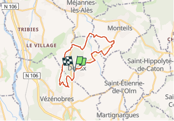
Deaux

JMJ42
User

Length
13.3 km

Max alt
214 m

Uphill gradient
175 m
Km-Effort
15.6 km

Min alt
111 m

Downhill gradient
173 m
Boucle
Yes
Creation date :
2024-01-23 08:33:31.593
Updated on :
2024-01-23 13:30:45.965
4h20
Difficulty : Easy

FREE GPS app for hiking
 SityTrail
IGN / Geographical institutes
SityTrail Plus
The world is yours!
About
Trail Walking of 13.3 km to be discovered at Occitania, Gard, Deaux. This trail is proposed by JMJ42.
Positioning
Country:
France
Region :
Occitania
Department/Province :
Gard
Municipality :
Deaux
Location:
Unknown
Start:(Dec)
Start:(UTM)
592018 ; 4879919 (31T) N.
Comments