


Coursegoule, Sommets Vierou et Prêt

GrouGary
User
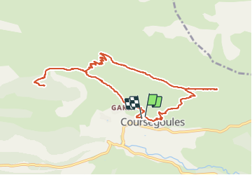

Length
12.2 km

Max alt
1415 m

Uphill gradient
542 m
Km-Effort
19.5 km

Min alt
1014 m

Downhill gradient
552 m
Boucle
Yes
Creation date :
2024-01-26 08:53:11.078
Updated on :
2024-01-27 08:19:47.973
5h53
Difficulty : Very easy

FREE GPS app for hiking
 SityTrail
IGN / Geographical institutes
SityTrail Plus
The world is yours!
About
Trail Walking of 12.2 km to be discovered at Provence-Alpes-Côte d'Azur, Maritime Alps, Coursegoules. This trail is proposed by GrouGary.
Description
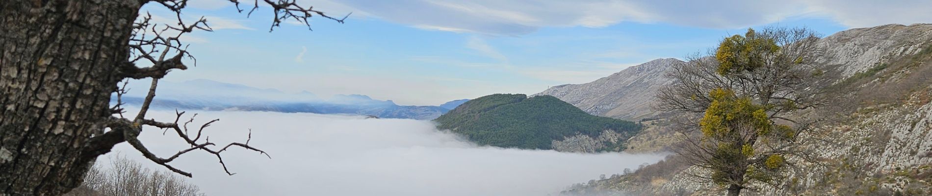
Petite rando d'hiver sans difficulté. 542, 12 km
Photos


Positioning
Country:
France
Region :
Provence-Alpes-Côte d'Azur
Department/Province :
Maritime Alps
Municipality :
Coursegoules
Location:
Unknown
Start:(Dec)
Start:(UTM)
342506 ; 4850956 (32T) N.
Comments