


Espace Biezin DECINES

chuck
User

Length
10.9 km

Max alt
230 m

Uphill gradient
89 m
Km-Effort
12.1 km

Min alt
186 m

Downhill gradient
89 m
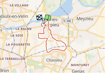
Boucle
Yes
Creation date :
2024-01-28 09:21:16.39
Updated on :
2024-01-28 17:21:02.364
2h51
Difficulty : Very easy

FREE GPS app for hiking
 SityTrail
IGN / Geographical institutes
SityTrail Plus
The world is yours!
About
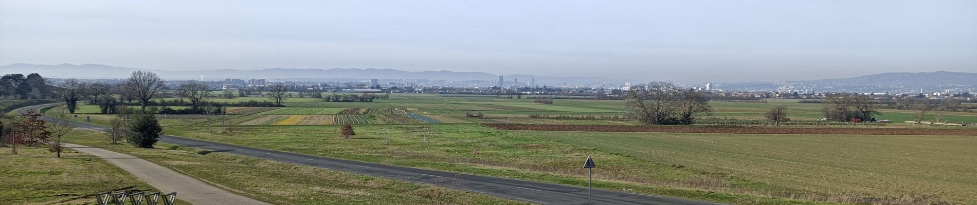
Trail Walking of 10.9 km to be discovered at Auvergne-Rhône-Alpes, Métropole de Lyon, Décines-Charpieu. This trail is proposed by chuck.
Description
Topo guide le Grand Lyon à pied
Photos


Positioning
Country:
France
Region :
Auvergne-Rhône-Alpes
Department/Province :
Métropole de Lyon
Municipality :
Décines-Charpieu
Location:
Unknown
Start:(Dec)
Start:(UTM)
652081 ; 5070558 (31T) N.
Comments