


Combegrasse Fontclairant Ventouse

Papou63patrick
User
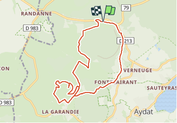

Length
10.1 km

Max alt
1114 m

Uphill gradient
255 m
Km-Effort
13.5 km

Min alt
934 m

Downhill gradient
255 m
Boucle
Yes
Creation date :
2024-01-28 13:03:40.0
Updated on :
2024-01-28 15:47:39.521
2h42
Difficulty : Easy

FREE GPS app for hiking
 SityTrail
IGN / Geographical institutes
SityTrail Plus
The world is yours!
About
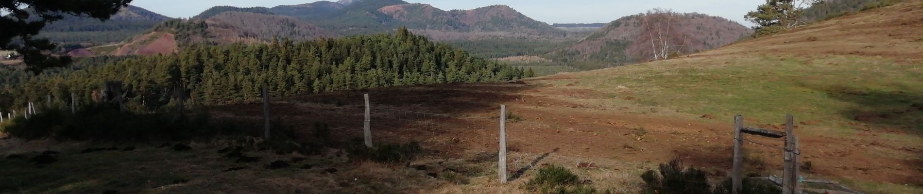
Trail Walking of 10.1 km to be discovered at Auvergne-Rhône-Alpes, Puy-de-Dôme, Aydat. This trail is proposed by Papou63patrick.
Photos


Positioning
Country:
France
Region :
Auvergne-Rhône-Alpes
Department/Province :
Puy-de-Dôme
Municipality :
Aydat
Location:
Unknown
Start:(Dec)
Start:(UTM)
497012 ; 5058831 (31T) N.
Comments