


les merles 2

cb8310
User
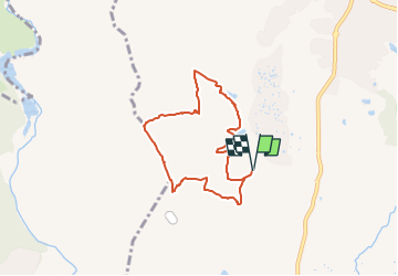

Length
6.6 km

Max alt
93 m

Uphill gradient
97 m
Km-Effort
7.9 km

Min alt
30 m

Downhill gradient
97 m
Boucle
Yes
Creation date :
2024-01-29 09:45:51.304
Updated on :
2025-02-05 17:47:05.223
1h47
Difficulty : Medium

FREE GPS app for hiking
 SityTrail
IGN / Geographical institutes
SityTrail Plus
The world is yours!
About
Trail Walking of 6.6 km to be discovered at Provence-Alpes-Côte d'Azur, Var, Roquebrune-sur-Argens. This trail is proposed by cb8310.
Description
rando imposssible,entrée barrée par un portail d'une propriété privée
Positioning
Country:
France
Region :
Provence-Alpes-Côte d'Azur
Department/Province :
Var
Municipality :
Roquebrune-sur-Argens
Location:
Unknown
Start:(Dec)
Start:(UTM)
308186 ; 4816893 (32T) N.
Comments