


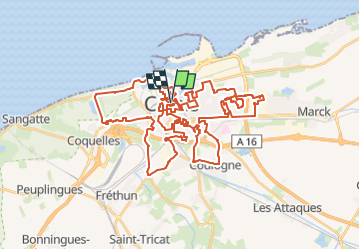
Visite de Calais

mathis01
User

Length
57 km

Max alt
16 m

Uphill gradient
233 m
Km-Effort
60 km

Min alt
-4 m

Downhill gradient
235 m
Boucle
Yes
Creation date :
2024-02-02 20:03:17.416
Updated on :
2024-02-03 14:53:33.278
12h43
Difficulty : Very difficult
2h39
Difficulty : Very difficult

FREE GPS app for hiking
 SityTrail
IGN / Geographical institutes
SityTrail Plus
The world is yours!
About
Trail On foot of 57 km to be discovered at Hauts-de-France, Pas-de-Calais, Calais. This trail is proposed by mathis01.
Positioning
Country:
France
Region :
Hauts-de-France
Department/Province :
Pas-de-Calais
Municipality :
Calais
Location:
Unknown
Start:(Dec)
Start:(UTM)
419510 ; 5645189 (31U) N.
Comments