SityTrail - La Trappe - Ch Ste Rolande

alainphilippe
User
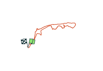

Length
12.3 km

Max alt
247 m

Uphill gradient
203 m
Km-Effort
15 km

Min alt
191 m

Downhill gradient
203 m
Boucle
Yes
Creation date :
2024-02-04 15:35:04.276
Updated on :
2024-02-16 11:23:01.807
3h24
Difficulty : Difficult
0m
Difficulty : Medium

FREE GPS app for hiking
 SityTrail
IGN / Geographical institutes
SityTrail Plus
The world is yours!
About
Trail Walking of 12.3 km to be discovered at Wallonia, Hainaut, Chimay. This trail is proposed by alainphilippe.


Positioning
Country:
Belgium
Region :
Wallonia
Department/Province :
Hainaut
Municipality :
Chimay
Location:
Unknown
Start:(Dec)
Start:(UTM)
594720 ; 5544794 (31U) N.
Comments