


Fort de Mutzig

apa
User
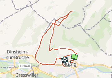

Length
9.9 km

Max alt
357 m

Uphill gradient
237 m
Km-Effort
13.1 km

Min alt
192 m

Downhill gradient
239 m
Boucle
Yes
Creation date :
2024-02-04 13:10:31.337
Updated on :
2024-02-04 15:40:32.623
2h29
Difficulty : Difficult

FREE GPS app for hiking
 SityTrail
IGN / Geographical institutes
SityTrail Plus
The world is yours!
About
Trail Walking of 9.9 km to be discovered at Grand Est, Bas-Rhin, Mutzig. This trail is proposed by apa.
Photos


Positioning
Country:
France
Region :
Grand Est
Department/Province :
Bas-Rhin
Municipality :
Mutzig
Location:
Unknown
Start:(Dec)
Start:(UTM)
386042 ; 5377437 (32U) N.
Comments