


boissy l'allerie

olivieraron
User
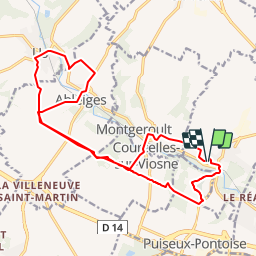

Length
18.2 km

Max alt
117 m

Uphill gradient
351 m
Km-Effort
23 km

Min alt
40 m

Downhill gradient
348 m
Boucle
Yes
Creation date :
2019-01-14 09:46:00.645
Updated on :
2019-01-14 09:46:00.702
5h00
Difficulty : Unknown

FREE GPS app for hiking
 SityTrail
IGN / Geographical institutes
SityTrail Plus
The world is yours!
About
Trail Other activity of 18.2 km to be discovered at Ile-de-France, Val-d'Oise, Boissy-l'Aillerie. This trail is proposed by olivieraron.
Positioning
Country:
France
Region :
Ile-de-France
Department/Province :
Val-d'Oise
Municipality :
Boissy-l'Aillerie
Location:
Unknown
Start:(Dec)
Start:(UTM)
428808 ; 5436397 (31U) N.
Comments