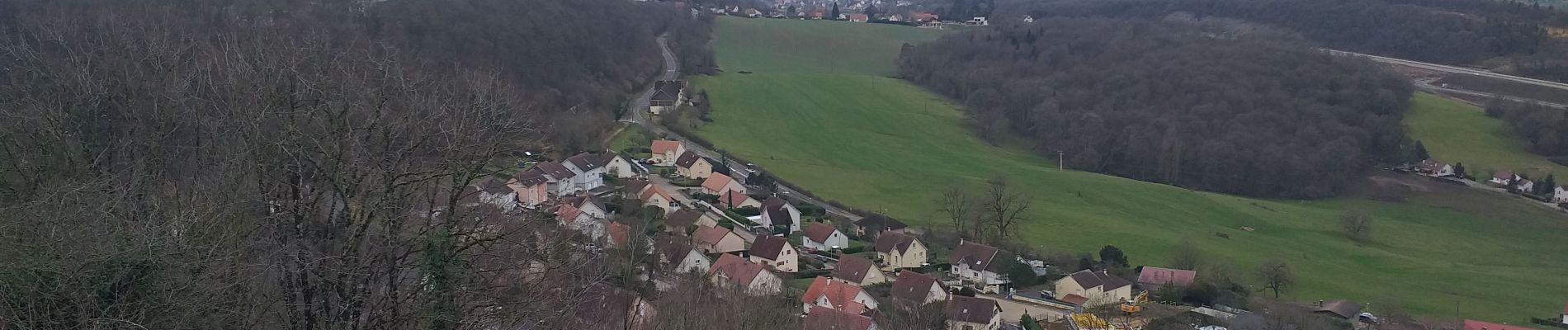
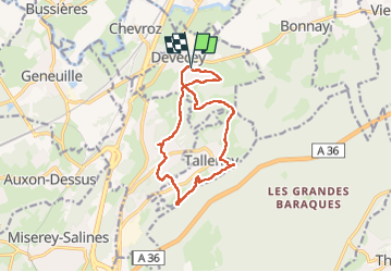
Trail Walking Devecey - devecey - Photo
© OpenStreetMap contributors
Length
Length
12.3 km
Max alt
Max alt
475 m
Uphill gradient
Uphill gradient
407 m
Km-Effort
Km-Effort  
17.8 km
Min alt
Min alt
221 m
Downhill gradient
Downhill gradient
408 m
Boucle
Boucle
Yes
Creation date :
2024-02-05 09:07:40.726
Updated on :
2024-02-08 19:29:36.807

(0 Reviews)

Walking
Walking
5h00
Difficulty : Easy

Scan this QR Code to open this trail in the SityTrail application

FREE GPS app for hiking

Logo SityTrail SityTrail

IGN / Geographical institutes

Download SityTrail from the App Store Download SityTrail from Google Play

Logo SityTrail SityTrail Plus

The world is yours!

Download SityTrail from the App Store Download SityTrail from Google Play Download SityTrail on Huawei AppGallery

About

Trail Walking of 12.3 km to be discovered at Bourgogne-Franche-Comté, Doubs, Devecey. This trail is proposed by eltonnermou.

Description

parking de la mairie (proche église)
Randonnée à travers bois et prairies, qui vous emmène de la plaine aux pentes du fort de la dame blanche puis à la plaine.
De belles maisons à observer lors de la traversée des villages ; Tallenay avec les belles bornes royales, Chatillon le duc son point de vue (derrière église) et son château.

Elevation profile

Photos

Positioning

Country:
France
Region :
Bourgogne-Franche-Comté
Department/Province :
Doubs
Municipality :
Devecey
Location:
Unknown
Start:(UTM)
274489 ; 5245582 (32T) N.


Close
My subscriptions