


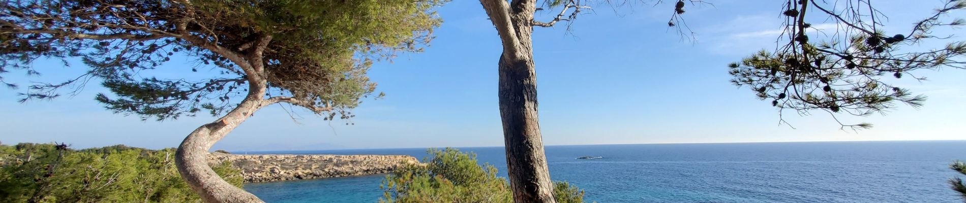
Cap Couronne

TOULAUDIN
User
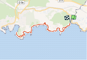

Length
10.9 km

Max alt
20 m

Uphill gradient
105 m
Km-Effort
12.3 km

Min alt
0 m

Downhill gradient
106 m
Boucle
Yes
Creation date :
2024-02-05 10:23:29.7
Updated on :
2024-02-13 17:40:48.55
3h58
Difficulty : Easy

FREE GPS app for hiking
 SityTrail
IGN / Geographical institutes
SityTrail Plus
The world is yours!
About
Trail Walking of 10.9 km to be discovered at Provence-Alpes-Côte d'Azur, Bouches-du-Rhône, Martigues. This trail is proposed by TOULAUDIN.
Description
A/R pas de difficultés, j'ai évités un départ de Sausset les pins car
parcours piéton le long de la route
Photos


Positioning
Country:
France
Region :
Provence-Alpes-Côte d'Azur
Department/Province :
Bouches-du-Rhône
Municipality :
Martigues
Location:
Unknown
Start:(Dec)
Start:(UTM)
669262 ; 4799938 (31T) N.
Comments