Trail Walking Martigues - Cap Couronne - Photo
© OpenStreetMap contributors
Length
Length
10.9 km
Max alt
Max alt
20 m
Uphill gradient
Uphill gradient
105 m
Km-Effort
Km-Effort  
12.3 km
Min alt
Min alt
0 m
Downhill gradient
Downhill gradient
106 m
Boucle
Boucle
Yes
Creation date :
2024-02-05 10:23:29.7
Updated on :
2024-02-13 17:40:48.55

(0 Reviews)

Walking
Walking
3h58
Difficulty : Easy

Scan this QR Code to open this trail in the SityTrail application

FREE GPS app for hiking

Logo SityTrail SityTrail

IGN / Geographical institutes

Download SityTrail from the App Store Download SityTrail from Google Play

Logo SityTrail SityTrail World

The world is yours!

Download SityTrail from the App Store Download SityTrail from Google Play Download SityTrail on Huawei AppGallery

About

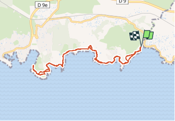
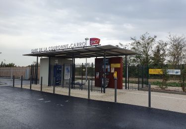
Trail Walking of 10.9 km to be discovered at Provence-Alpes-Côte d'Azur, Bouches-du-Rhône, Martigues. This trail is proposed by TOULAUDIN.

Description

A/R pas de difficultés, j'ai évités un départ de Sausset les pins car
parcours piéton le long de la route  

Elevation profile

Photos

Positioning

Country:
France
Region :
Provence-Alpes-Côte d'Azur
Department/Province :
Bouches-du-Rhône
Municipality :
Martigues
Location:
Unknown
Start:(UTM)
669262 ; 4799938 (31T) N.

Trails nearby

Trail Walking Martigues - PF-La Côte bleue - Cap Couronne - Photo
Walking
MicDul

Walking

Very easy
(2)
Martigues, Provence-Alpes-Côte d'Azur, Bouches-du-Rhône, France
21 km | 24 km-effort
5h 18min
Yes
Trail Walking Martigues - Cap couronne  - Photo
Walking
GUIDE
nadinebondoux

Walking

Medium
Martigues, Provence-Alpes-Côte d'Azur, Bouches-du-Rhône, France
21 km | 25 km-effort
5h 17min
Yes
Trail On foot Martigues - Les carrières de pierre de La Couronne - Photo
On foot
PRO

On foot

Easy
Martigues, Provence-Alpes-Côte d'Azur, Bouches-du-Rhône, France
3.1 km | 3.4 km-effort
45min
No
Trail On foot Martigues - Boucle de Boumandariel - Photo
On foot
PRO

On foot

Easy
Martigues, Provence-Alpes-Côte d'Azur, Bouches-du-Rhône, France
5.8 km | 6.6 km-effort
1h 30min
Yes
Trail On foot Martigues - Sentier botanique de la plaine de Carro - Photo
On foot
PRO

On foot

Easy
Martigues, Provence-Alpes-Côte d'Azur, Bouches-du-Rhône, France
3.9 km | 4.3 km-effort
58min
Yes
Trail On foot Martigues - Le Cap Couronne - Photo
On foot
PRO

On foot

Medium
Martigues, Provence-Alpes-Côte d'Azur, Bouches-du-Rhône, France
20 km | 24 km-effort
5h 22min
No
Trail On foot Sausset-les-Pins - Mer et Pinéde Valapoux - Photo
On foot
PRO

On foot

Easy
Sausset-les-Pins, Provence-Alpes-Côte d'Azur, Bouches-du-Rhône, France
6.6 km | 7.9 km-effort
1h 47min
Yes
Trail On foot Sausset-les-Pins - Grand Vallat - Littoral - Photo
On foot
PRO

On foot

Easy
Sausset-les-Pins, Provence-Alpes-Côte d'Azur, Bouches-du-Rhône, France
4.9 km | 5.9 km-effort
1h 20min
Yes
Trail On foot Martigues - Mer et colline Valestéloué - Photo
On foot
PRO

On foot

Easy
Martigues, Provence-Alpes-Côte d'Azur, Bouches-du-Rhône, France
14.5 km | 17.8 km-effort
4h 2min
Yes


Close
My subscriptions