


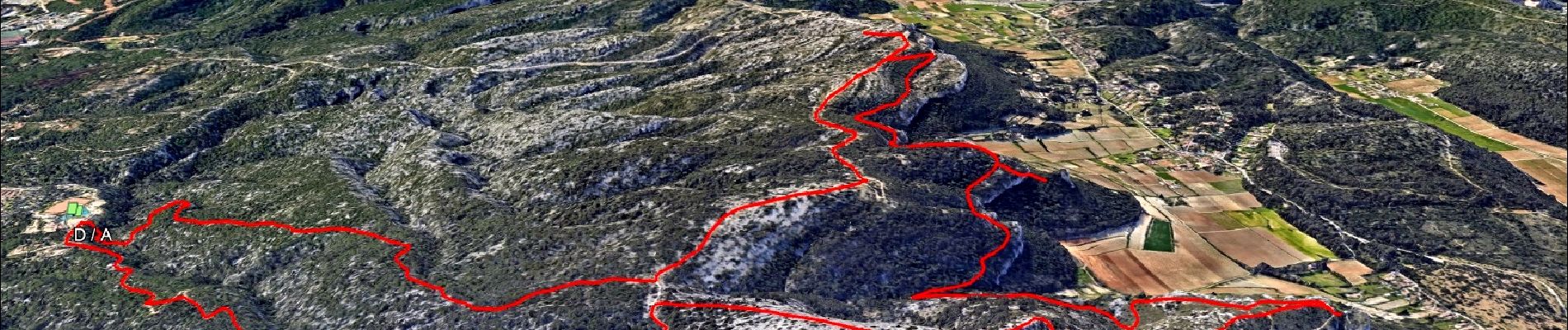
Autour du Montounier 2eme version

affinetataille
User GUIDE

Length
15.7 km

Max alt
558 m

Uphill gradient
595 m
Km-Effort
24 km

Min alt
175 m

Downhill gradient
597 m
Boucle
Yes
Creation date :
2024-02-07 16:49:24.897
Updated on :
2024-03-18 14:08:19.919
6h00
Difficulty : Medium

FREE GPS app for hiking
 SityTrail
IGN / Geographical institutes
SityTrail Plus
The world is yours!
About
Trail Walking of 15.7 km to be discovered at Provence-Alpes-Côte d'Azur, Bouches-du-Rhône, Ceyreste. This trail is proposed by affinetataille.
Photos


31 photos in total. Please click on a photo to see them all in the gallery.
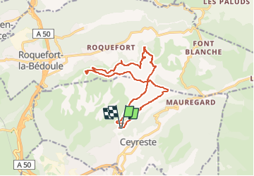
Positioning
Country:
France
Region :
Provence-Alpes-Côte d'Azur
Department/Province :
Bouches-du-Rhône
Municipality :
Ceyreste
Location:
Unknown
Start:(Dec)
Start:(UTM)
713686 ; 4788966 (31T) N.
Comments