


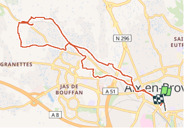
FFR Rotonde Parons 8 février 2024

rlebasque
User

Length
12.4 km

Max alt
237 m

Uphill gradient
140 m
Km-Effort
14.3 km

Min alt
182 m

Downhill gradient
137 m
Boucle
No
Creation date :
2024-02-08 08:36:55.359
Updated on :
2024-02-08 14:57:36.907
6h19
Difficulty : Difficult

FREE GPS app for hiking
 SityTrail
IGN / Geographical institutes
SityTrail Plus
The world is yours!
About
Trail Walking of 12.4 km to be discovered at Provence-Alpes-Côte d'Azur, Bouches-du-Rhône, Aix-en-Provence. This trail is proposed by rlebasque.
Positioning
Country:
France
Region :
Provence-Alpes-Côte d'Azur
Department/Province :
Bouches-du-Rhône
Municipality :
Aix-en-Provence
Location:
Unknown
Start:(Dec)
Start:(UTM)
697525 ; 4822145 (31T) N.
Comments