


Prades&Montaillou

crognon
User
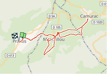

Length
12.1 km

Max alt
1348 m

Uphill gradient
358 m
Km-Effort
16.9 km

Min alt
1212 m

Downhill gradient
359 m
Boucle
Yes
Creation date :
2024-02-09 09:29:14.022
Updated on :
2024-02-09 14:31:27.372
5h01
Difficulty : Easy

FREE GPS app for hiking
 SityTrail
IGN / Geographical institutes
SityTrail Plus
The world is yours!
About
Trail Walking of 12.1 km to be discovered at Occitania, Ariège, Prades. This trail is proposed by crognon.
Positioning
Country:
France
Region :
Occitania
Department/Province :
Ariège
Municipality :
Prades
Location:
Unknown
Start:(Dec)
Start:(UTM)
408166 ; 4737647 (31T) N.
Comments