


sentier Hollard et grotte de la grande cave

dcharbonnier
User
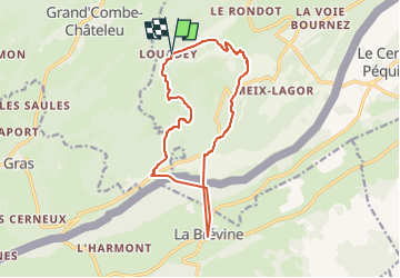

Length
14 km

Max alt
1231 m

Uphill gradient
592 m
Km-Effort
22 km

Min alt
826 m

Downhill gradient
593 m
Boucle
Yes
Creation date :
2024-02-09 19:32:31.046
Updated on :
2024-02-09 19:32:33.021
4h59
Difficulty : Difficult

FREE GPS app for hiking
 SityTrail
IGN / Geographical institutes
SityTrail Plus
The world is yours!
About
Trail Walking of 14 km to be discovered at Bourgogne-Franche-Comté, Doubs, Montlebon. This trail is proposed by dcharbonnier.
Positioning
Country:
France
Region :
Bourgogne-Franche-Comté
Department/Province :
Doubs
Municipality :
Montlebon
Location:
Unknown
Start:(Dec)
Start:(UTM)
317275 ; 5209983 (32T) N.
Comments