


7.6 km | 9.3 km-effort
![Trail Walking Saint-Mard-de-Réno - [Itinéraire] La chute de Beillard - Départ de Saint-Mard - Photo](https://media.geolcdn.com/t/1900/400/ext.pjpeg?maxdim=2&url=https%3A%2F%2Fstatic1.geolcdn.com%2Fsiteimages%2Fupload%2Ffiles%2F1553511878bg_sport_marche.png)

User


FREE GPS app for hiking
 SityTrail
IGN / Geographical institutes
SityTrail World
The world is yours!
Trail Walking of 8.1 km to be discovered at Normandy, Orne, Saint-Mard-de-Réno. This trail is proposed by ODDAD78.
Situés à la lisière de la forêt de Réno-Valdieu, les villages voisins de Saint-Mard-de-Réno et de La Chapelle-Montligeon, dont le passé est étroitement lié à ce massif forestier depuis les origines médiévales, proposent ensemble ce circuit qui pourra vous mener d’un village à l’autre.
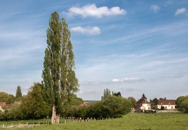
Une proposition originale : on pourra choisir de suivre cet itinéraire au départ du bourg de Saint-Mard-de-Réno ou de celui de La Chapelle-Montligeon. La moitié du parcours se fera à travers campagne et hameaux avec une belle vue sur le massif forestier de Réno-Valdieu ; l’autre moitié, le long du cours de la Villette, permettra de découvrir cette petite rivière qui longe tout le massif forestier.
Pas à pas (Rando-Perche)
Départ : Saint-Mard-de-Réno Arrivée : Saint-Mard-de-Réno Communes : 1. Saint-Mard-de-Réno 2. La Chapelle-Montligeon
1. A l’église, prendre la D306 en direction de Courgeon. A 500m, au carrefour, prendre à gauche vers le hameau Assite.
2. Au premier carrefour à droite, emprunter un chemin d’abord goudronné jusqu’aux dernières maisons puis en herbe jusqu’au hameau Le Chêne (passage parfois humide). Prendre à gauche le chemin goudronné, puis tout droit derrière les bâtiments, le chemin de terre.
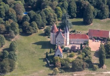
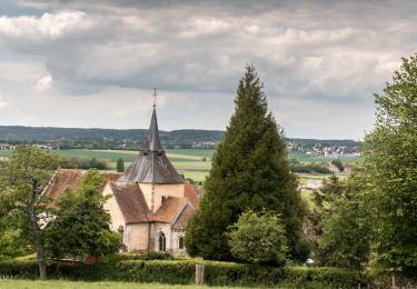
3. Ce chemin tourne à droite à angle droit, d’abord ombragé (et humide). Remonter en face le chemin de terre débouchant sur la VC2. La traverser et continuer tout droit sur 400m. A la rencontre d’un autre chemin de terre, tourner à gauche et rejoindre la D5. A droite sur 150m puis à gauche devant le poney-club, la salle omnisports et le plan d’eau. On est alors sur le tracé de la « Ligne du tram ». De cet endroit on peut gagner, si on le souhaite, le bourg de La Chapelle-Montligeon et y visiter sa basilique.
4. Après le plan d’eau, prendre à gauche un chemin creux qui, devenant herbeux, suit la vallée de la Villette.
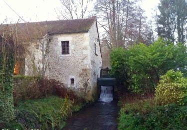
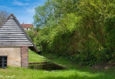
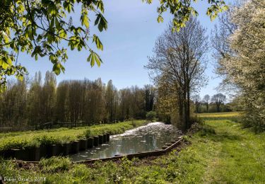
5. En bout de ligne droite, prendre le chemin à gauche, franchir la passerelle en béton sur la rivière, puis une deuxième sur un bief pour arriver au hameau de Psot. Suivre à droite en traversant la cour commune entre deux maisons. Longer ensuite le bief jusqu’à l’Hôtel Chauvin. Tourner à gauche derrière la maison et, par un chemin pierré, rejoindre Beillard. Suivre le chemin goudronné qui contourne une propriété entourée de murs et, juste après, prendre à droite puis à gauche. Longer le cours de l’ancien bief du moulin jusqu’au barrage (Attention ! Le barrage s'est effondré en janvier 2023, travaux en attente).
6. Tourner à gauche et remonter par un chemin caillouteux pour gagner la D5. La traverser et continuer tout droit par un chemin parfois humide jusqu’à une petite route goudronnée. La suivre à droite sur 300m jusqu’au point 2 sur la carte. De ce point on peut regagner le bourg de Saint- Mard-de-Réno en continuant tout droit par l’itinéraire de départ.
7. Pour retourner à La Chapelle-Montligeon, tourner à gauche vers le Houx et suivre le descriptif depuis le point 1.

On foot
![Trail Walking La Chapelle-Montligeon - [Itinéraire] Le Mont Ligeon - Photo](https://media.geolcdn.com/t/375/260/ext.jpg?maxdim=2&url=https%3A%2F%2Fmedia.geolcdn.com%2Ff%2Fce92da88-fb92-411f-965d-5e4e270d0f79.jpeg)
Walking
Walking
Walking
Walking
Walking
Walking
Walking
Walking