


roussas

collot
User
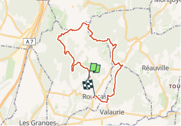

Length
16.2 km

Max alt
380 m

Uphill gradient
361 m
Km-Effort
21 km

Min alt
111 m

Downhill gradient
423 m
Boucle
No
Creation date :
2024-02-11 09:28:02.372
Updated on :
2024-02-11 15:57:51.857
6h29
Difficulty : Medium

FREE GPS app for hiking
 SityTrail
IGN / Geographical institutes
SityTrail Plus
The world is yours!
About
Trail Walking of 16.2 km to be discovered at Auvergne-Rhône-Alpes, Drôme, Roussas. This trail is proposed by collot.
Positioning
Country:
France
Region :
Auvergne-Rhône-Alpes
Department/Province :
Drôme
Municipality :
Roussas
Location:
Unknown
Start:(Dec)
Start:(UTM)
643054 ; 4922144 (31T) N.
Comments