


gespunsart2.2024.02.13

trusgnachjf
User
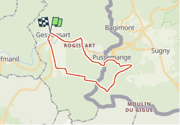

Length
12.5 km

Max alt
411 m

Uphill gradient
355 m
Km-Effort
17.2 km

Min alt
195 m

Downhill gradient
355 m
Boucle
Yes
Creation date :
2024-02-13 12:42:30.588
Updated on :
2024-02-13 15:59:15.053
3h16
Difficulty : Difficult

FREE GPS app for hiking
 SityTrail
IGN / Geographical institutes
SityTrail Plus
The world is yours!
About
Trail Walking of 12.5 km to be discovered at Grand Est, Ardennes, Gespunsart. This trail is proposed by trusgnachjf.
Positioning
Country:
France
Region :
Grand Est
Department/Province :
Ardennes
Municipality :
Gespunsart
Location:
Unknown
Start:(Dec)
Start:(UTM)
631449 ; 5520412 (31U) N.
Comments