


Casque du Lheris

chrisgps
User
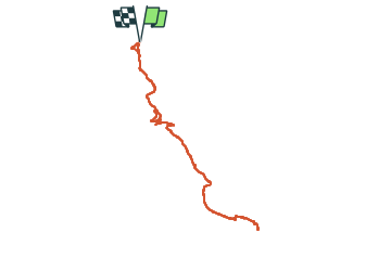

Length
16.8 km

Max alt
1577 m

Uphill gradient
861 m
Km-Effort
28 km

Min alt
811 m

Downhill gradient
861 m
Boucle
Yes
Creation date :
2024-02-14 08:04:12.776
Updated on :
2024-02-15 17:43:09.493
6h25
Difficulty : Medium

FREE GPS app for hiking
 SityTrail
IGN / Geographical institutes
SityTrail Plus
The world is yours!
About
Trail Walking of 16.8 km to be discovered at Occitania, Hautespyrenees, Gerde. This trail is proposed by chrisgps.
Description
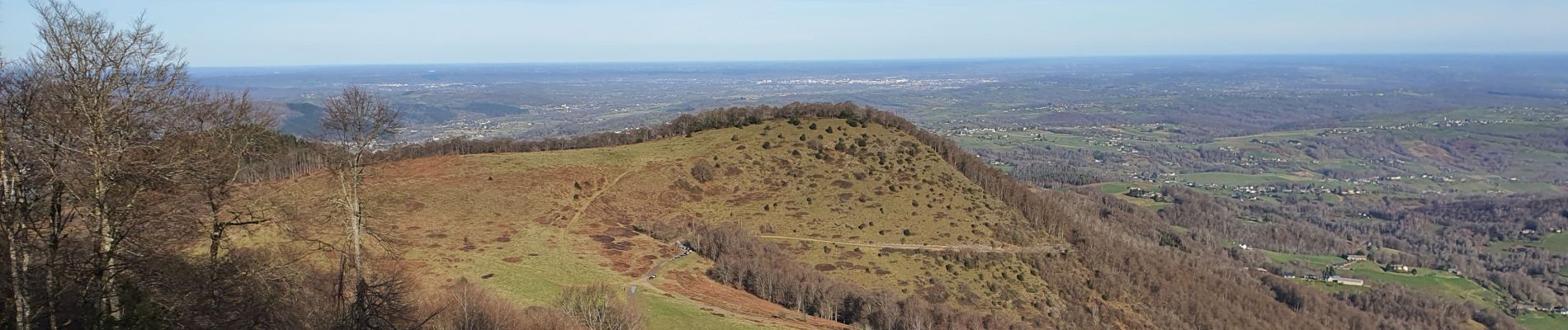
très agréable aller-retour malgré la raideur de la pente terminale. mais très beau panorama au sommet qui se mérite........!
Photos


Positioning
Country:
France
Region :
Occitania
Department/Province :
Hautespyrenees
Municipality :
Gerde
Location:
Unknown
Start:(Dec)
Start:(UTM)
271517 ; 4771026 (31T) N.
Comments