


Chapelle st christine

soca
User
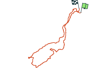

Length
10.3 km

Max alt
321 m

Uphill gradient
310 m
Km-Effort
14.4 km

Min alt
136 m

Downhill gradient
304 m
Boucle
No
Creation date :
2024-02-15 08:43:23.559
Updated on :
2024-02-15 17:07:07.906
3h11
Difficulty : Easy

FREE GPS app for hiking
 SityTrail
IGN / Geographical institutes
SityTrail Plus
The world is yours!
About
Trail Walking of 10.3 km to be discovered at Provence-Alpes-Côte d'Azur, Var, Cuers. This trail is proposed by soca.
Photos

Positioning
Country:
France
Region :
Provence-Alpes-Côte d'Azur
Department/Province :
Var
Municipality :
Cuers
Location:
Unknown
Start:(Dec)
Start:(UTM)
262325 ; 4791150 (32T) N.
Comments