


ec

jpd45650
User
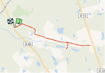

Length
8.7 km

Max alt
134 m

Uphill gradient
76 m
Km-Effort
9.7 km

Min alt
117 m

Downhill gradient
75 m
Boucle
Yes
Creation date :
2015-03-12 00:00:00.0
Updated on :
2015-03-12 00:00:00.0
2h21
Difficulty : Unknown

FREE GPS app for hiking
 SityTrail
IGN / Geographical institutes
SityTrail Plus
The world is yours!
About
Trail Other activity of 8.7 km to be discovered at Centre-Loire Valley, Loiret, Sennely. This trail is proposed by jpd45650.
Positioning
Country:
France
Region :
Centre-Loire Valley
Department/Province :
Loiret
Municipality :
Sennely
Location:
Unknown
Start:(Dec)
Start:(UTM)
432052 ; 5285118 (31T) N.
Comments