


st izaire douce

CASSISFRAMBOISE
User
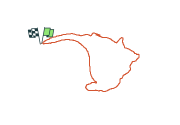

Length
8.5 km

Max alt
478 m

Uphill gradient
266 m
Km-Effort
12 km

Min alt
266 m

Downhill gradient
267 m
Boucle
Yes
Creation date :
2024-02-16 07:23:35.442
Updated on :
2024-02-17 19:24:44.347
1h55
Difficulty : Easy

FREE GPS app for hiking
 SityTrail
IGN / Geographical institutes
SityTrail Plus
The world is yours!
About
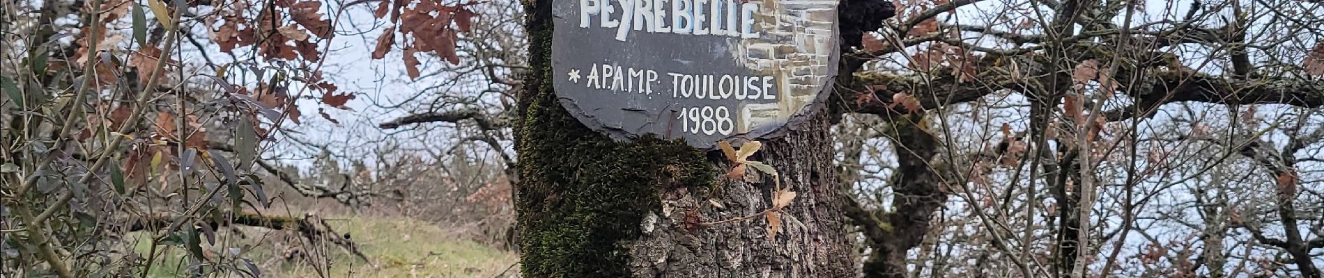
Trail Walking of 8.5 km to be discovered at Occitania, Aveyron, Saint-Izaire. This trail is proposed by CASSISFRAMBOISE.
Photos

Positioning
Country:
France
Region :
Occitania
Department/Province :
Aveyron
Municipality :
Saint-Izaire
Location:
Unknown
Start:(Dec)
Start:(UTM)
478022 ; 4868961 (31T) N.
Comments