


ferrassieres.croix blanche

NADINE52
User
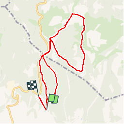

Length
10.9 km

Max alt
1261 m

Uphill gradient
318 m
Km-Effort
14.9 km

Min alt
1104 m

Downhill gradient
269 m
Boucle
No
Creation date :
2015-03-13 00:00:00.0
Updated on :
2015-03-13 00:00:00.0
4h09
Difficulty : Easy

FREE GPS app for hiking
 SityTrail
IGN / Geographical institutes
SityTrail Plus
The world is yours!
About
Trail Other activity of 10.9 km to be discovered at Auvergne-Rhône-Alpes, Drôme, Ferrassières. This trail is proposed by NADINE52.
Positioning
Country:
France
Region :
Auvergne-Rhône-Alpes
Department/Province :
Drôme
Municipality :
Ferrassières
Location:
Unknown
Start:(Dec)
Start:(UTM)
699879 ; 4890820 (31T) N.
Comments