


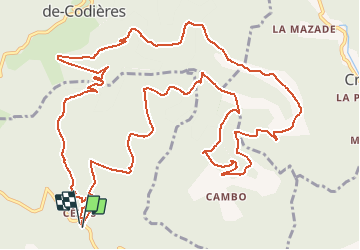
Cézas et la Montagne de la Fage

ARVIEU
User

Length
18.3 km

Max alt
877 m

Uphill gradient
702 m
Km-Effort
28 km

Min alt
530 m

Downhill gradient
695 m
Boucle
Yes
Creation date :
2015-03-13 00:00:00.0
Updated on :
2015-03-13 00:00:00.0
5h53
Difficulty : Medium

FREE GPS app for hiking
 SityTrail
IGN / Geographical institutes
SityTrail Plus
The world is yours!
About
Trail Walking of 18.3 km to be discovered at Occitania, Gard, Sumène. This trail is proposed by ARVIEU.
Description
La montagne de la Fage au départ de Cézas
Positioning
Country:
France
Region :
Occitania
Department/Province :
Gard
Municipality :
Sumène
Location:
Unknown
Start:(Dec)
Start:(UTM)
562444 ; 4869404 (31T) N.
Comments