


Demandolx cremon 1000m 16kms

Danielba
User GUIDE
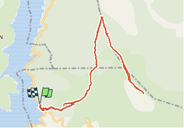

Length
14.8 km

Max alt
1743 m

Uphill gradient
931 m
Km-Effort
27 km

Min alt
889 m

Downhill gradient
927 m
Boucle
Yes
Creation date :
2024-02-18 07:55:38.647
Updated on :
2024-02-18 18:34:33.192
8h05
Difficulty : Very difficult

FREE GPS app for hiking
 SityTrail
IGN / Geographical institutes
SityTrail Plus
The world is yours!
About
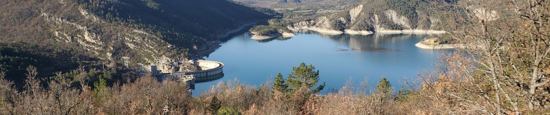
Trail Walking of 14.8 km to be discovered at Provence-Alpes-Côte d'Azur, Alpes-de-Haute-Provence, Demandolx. This trail is proposed by Danielba .
Photos


Positioning
Country:
France
Region :
Provence-Alpes-Côte d'Azur
Department/Province :
Alpes-de-Haute-Provence
Municipality :
Demandolx
Location:
Unknown
Start:(Dec)
Start:(UTM)
302417 ; 4861857 (32T) N.
Comments