


Essômes-sur-Marne du 20/02/2024

VANDERPUTTENMi
User GUIDE
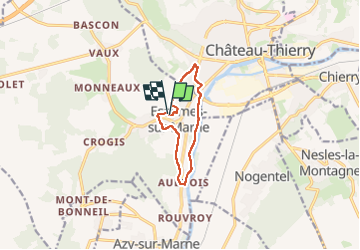

Length
8 km

Max alt
109 m

Uphill gradient
109 m
Km-Effort
9.4 km

Min alt
54 m

Downhill gradient
110 m
Boucle
Yes
Creation date :
2024-02-20 12:45:50.917
Updated on :
2024-02-20 16:42:48.764
1h49
Difficulty : Medium

FREE GPS app for hiking
 SityTrail
IGN / Geographical institutes
SityTrail Plus
The world is yours!
About
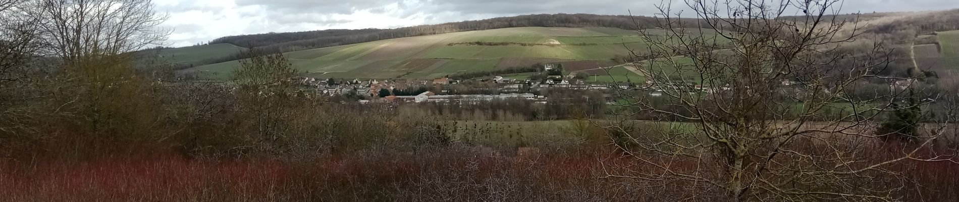
Trail Walking of 8 km to be discovered at Hauts-de-France, Aisne, Essômes-sur-Marne. This trail is proposed by VANDERPUTTENMi.
Photos

Positioning
Country:
France
Region :
Hauts-de-France
Department/Province :
Aisne
Municipality :
Essômes-sur-Marne
Location:
Unknown
Start:(Dec)
Start:(UTM)
527148 ; 5430973 (31U) N.
Comments