


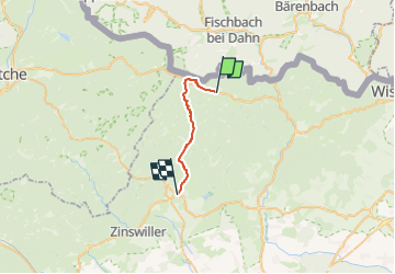
Triangle vert Obersteinbach Est - Niederbronn centre
© OpenStreetMap contributors


5h24
Difficulty : Very difficult


Length
16.2 km
Max alt
479 m
Uphill gradient
551 m
Km-Effort
24 km
Min alt
188 m
Downhill gradient
603 m
Boucle
No
Creation date :
2024-02-21 14:55:29.13
Updated on :
2024-02-21 23:15:19.682
5h24
Difficulty : Very difficult
FREE GPS app for hiking
 SityTrail
IGN / Geographical institutes
SityTrail Plus
The world is yours!
About
Trail Walking of 16.2 km to be discovered at Grand Est, Bas-Rhin, Obersteinbach. This trail is proposed by Dominique Baudelocque .
Positioning
Country:
France
Region :
Grand Est
Department/Province :
Bas-Rhin
Municipality :
Obersteinbach
Location:
Unknown
Start:(Dec)
Start:(UTM)
404316 ; 5432254 (32U) N.
Comments