lac David leamat robert

bymarc26
User
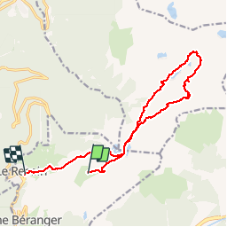

Length
16.8 km

Max alt
2279 m

Uphill gradient
647 m
Km-Effort
27 km

Min alt
1664 m

Downhill gradient
1229 m
Boucle
No
Creation date :
2015-03-14 00:00:00.0
Updated on :
2015-03-14 00:00:00.0
7h08
Difficulty : Unknown

FREE GPS app for hiking
 SityTrail
IGN / Geographical institutes
SityTrail Plus
The world is yours!
About
Trail Walking of 16.8 km to be discovered at Auvergne-Rhône-Alpes, Isère, Chamrousse. This trail is proposed by bymarc26.
Positioning
Country:
France
Region :
Auvergne-Rhône-Alpes
Department/Province :
Isère
Municipality :
Chamrousse
Location:
Unknown
Start:(Dec)
Start:(UTM)
728318 ; 5001018 (31T) N.
Comments