


2024-02-22_23h22m46_randonnee-des-mimosas-tanneron

Renefrt
User

Length
12.4 km

Max alt
480 m

Uphill gradient
371 m
Km-Effort
17.3 km

Min alt
155 m

Downhill gradient
373 m
Boucle
Yes
Creation date :
2024-02-22 22:22:46.258
Updated on :
2024-04-28 13:35:35.871
3h56
Difficulty : Difficult

FREE GPS app for hiking
 SityTrail
IGN / Geographical institutes
SityTrail Plus
The world is yours!
About
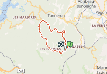
Trail Walking of 12.4 km to be discovered at Provence-Alpes-Côte d'Azur, Var, Tanneron. This trail is proposed by Renefrt.
Description
Randonnée des Mimosas - Tanneron
VAriante de ce topo https://docs.wixstatic.com/ugd/7eb3d5_c1511900b96d45719e8154dd6049926e.pdf
DEpart de penier plutot que de Tanneron
Positioning
Country:
France
Region :
Provence-Alpes-Côte d'Azur
Department/Province :
Var
Municipality :
Tanneron
Location:
Unknown
Start:(Dec)
Start:(UTM)
329341 ; 4825248 (32T) N.
Comments