


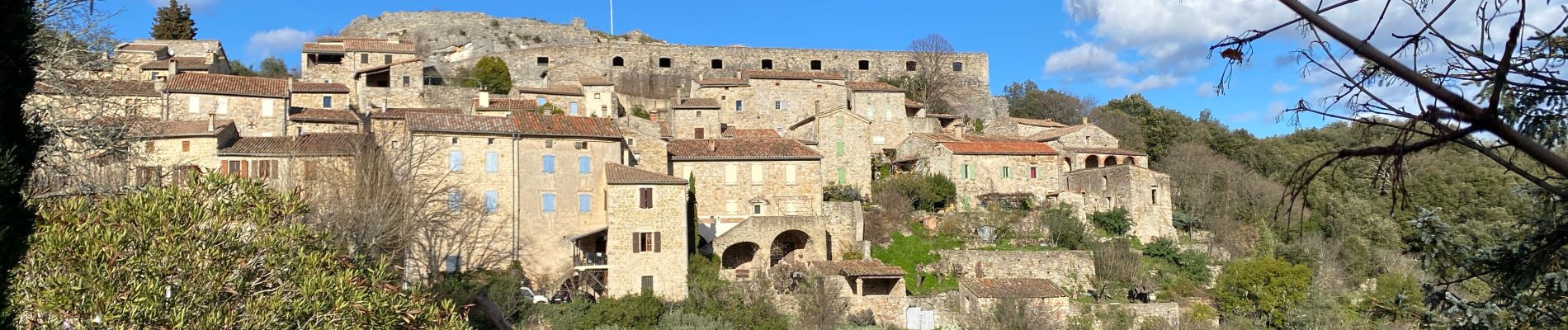
Banne Mimosas

Roger Philippe Wallez
User GUIDE
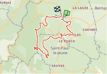

Length
19.8 km

Max alt
433 m

Uphill gradient
575 m
Km-Effort
28 km

Min alt
172 m

Downhill gradient
589 m
Boucle
No
Creation date :
2024-02-24 08:41:26.0
Updated on :
2024-02-25 08:42:08.668
6h31
Difficulty : Very difficult

FREE GPS app for hiking
 SityTrail
IGN / Geographical institutes
SityTrail Plus
The world is yours!
About
Trail Walking of 19.8 km to be discovered at Auvergne-Rhône-Alpes, Ardèche, Banne. This trail is proposed by Roger Philippe Wallez.
Photos


Positioning
Country:
France
Region :
Auvergne-Rhône-Alpes
Department/Province :
Ardèche
Municipality :
Banne
Location:
Unknown
Start:(Dec)
Start:(UTM)
592150 ; 4913076 (31T) N.
Comments