


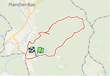
Plancher Bas

jacthiry
User

Length
8.2 km

Max alt
568 m

Uphill gradient
176 m
Km-Effort
10.5 km

Min alt
411 m

Downhill gradient
183 m
Boucle
Yes
Creation date :
2024-02-04 13:36:47.529
Updated on :
2024-02-25 16:32:33.754
2h28
Difficulty : Medium

FREE GPS app for hiking
 SityTrail
IGN / Geographical institutes
SityTrail Plus
The world is yours!
About
Trail Walking of 8.2 km to be discovered at Bourgogne-Franche-Comté, Haute-Saône, Plancher-Bas. This trail is proposed by jacthiry.
Positioning
Country:
France
Region :
Bourgogne-Franche-Comté
Department/Province :
Haute-Saône
Municipality :
Plancher-Bas
Location:
Unknown
Start:(Dec)
Start:(UTM)
330487 ; 5285548 (32T) N.
Comments