


Huldenberg, Up & Down

GaetanHouart
User
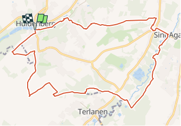

Length
12.1 km

Max alt
95 m

Uphill gradient
185 m
Km-Effort
14.5 km

Min alt
28 m

Downhill gradient
184 m
Boucle
Yes
Creation date :
2024-02-25 17:11:06.42
Updated on :
2024-02-25 17:12:22.126
3h18
Difficulty : Difficult

FREE GPS app for hiking
 SityTrail
IGN / Geographical institutes
SityTrail Plus
The world is yours!
About
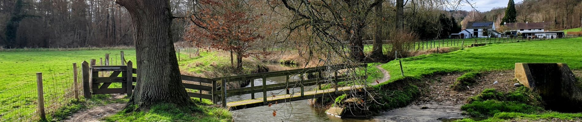
Trail Walking of 12.1 km to be discovered at Flanders, Flemish Brabant, Huldenberg. This trail is proposed by GaetanHouart.
Description
Par temps sec uniquement !
Photos


Positioning
Country:
Belgium
Region :
Flanders
Department/Province :
Flemish Brabant
Municipality :
Huldenberg
Location:
Huldenberg
Start:(Dec)
Start:(UTM)
611597 ; 5627422 (31U) N.
Comments