


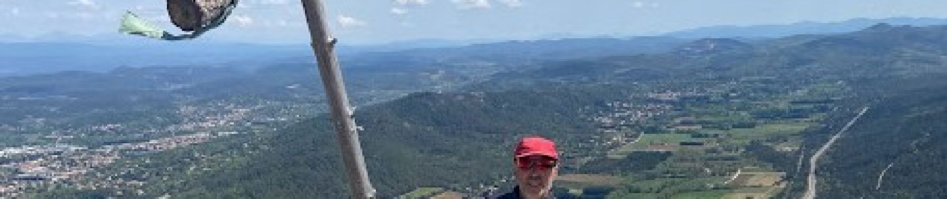
roc de candelon

frederic bruguier
User
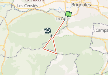

Length
6 km

Max alt
765 m

Uphill gradient
816 m
Km-Effort
15.8 km

Min alt
258 m

Downhill gradient
477 m
Boucle
No
Creation date :
2024-02-26 10:54:36.622
Updated on :
2024-02-26 10:56:03.46
3h34
Difficulty : Difficult

FREE GPS app for hiking
 SityTrail
IGN / Geographical institutes
SityTrail Plus
The world is yours!
About
Trail Walking of 6 km to be discovered at Provence-Alpes-Côte d'Azur, Var, La Celle. This trail is proposed by frederic bruguier.
Description
ascension du roc
Photos

Positioning
Country:
France
Region :
Provence-Alpes-Côte d'Azur
Department/Province :
Var
Municipality :
La Celle
Location:
Unknown
Start:(Dec)
Start:(UTM)
260473 ; 4808688 (32T) N.
Comments