


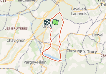
Ballade à Urcel et Monampteuil 02

José800
User

Length
10.9 km

Max alt
177 m

Uphill gradient
195 m
Km-Effort
13.5 km

Min alt
60 m

Downhill gradient
196 m
Boucle
Yes
Creation date :
2024-02-26 15:20:59.495
Updated on :
2024-02-26 15:23:17.088
3h04
Difficulty : Difficult

FREE GPS app for hiking
 SityTrail
IGN / Geographical institutes
SityTrail Plus
The world is yours!
About
Trail Walking of 10.9 km to be discovered at Hauts-de-France, Aisne, Urcel. This trail is proposed by José800.
Positioning
Country:
France
Region :
Hauts-de-France
Department/Province :
Aisne
Municipality :
Urcel
Location:
Unknown
Start:(Dec)
Start:(UTM)
540738 ; 5481884 (31U) N.
Comments