Trail Walking Saint-Geniez - Le Trainon - Photo
 Marco05
Marco05

User

© OpenStreetMap contributors
Length
Length
9.8 km
Max alt
Max alt
1636 m
Uphill gradient
Uphill gradient
562 m
Km-Effort
Km-Effort  
17.3 km
Min alt
Min alt
1117 m
Downhill gradient
Downhill gradient
562 m
Boucle
Boucle
Yes
Creation date :
2024-02-27 08:45:08.225
Updated on :
2024-02-29 17:24:10.375

(1 Reviews)

Walking
Walking
3h56
Difficulty : Medium

Scan this QR Code to open this trail in the SityTrail application

FREE GPS app for hiking

Logo SityTrail SityTrail

IGN / Geographical institutes

Download SityTrail from the App Store Download SityTrail from Google Play

Logo SityTrail SityTrail World

The world is yours!

Download SityTrail from the App Store Download SityTrail from Google Play Download SityTrail on Huawei AppGallery

About

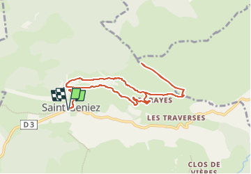
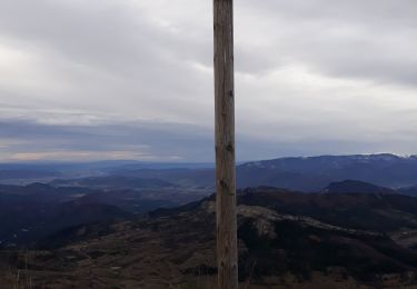
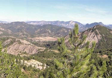
Trail Walking of 9.8 km to be discovered at Provence-Alpes-Côte d'Azur, Alpes-de-Haute-Provence, Saint-Geniez. This trail is proposed by Marco05.

Description

Ballade de difficulté moyenne au départ de Saint Geniez.
On peu stationner facilement sur la place du village.
C'est aussi le lieu du départ.
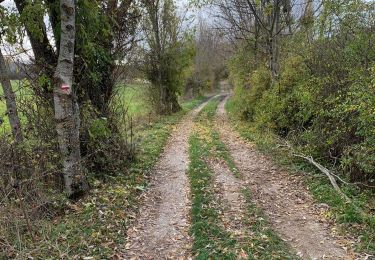
A la descente, on peut un peu rallonger le parcours en suivent une piste facile au nord de la montée.

Elevation profile

Photos

Positioning

Country:
France
Region :
Provence-Alpes-Côte d'Azur
Department/Province :
Alpes-de-Haute-Provence
Municipality :
Saint-Geniez
Location:
Unknown
Start:(UTM)
264649 ; 4903298 (32T) N.

Comments

Please log in to post a review or rate the element


Trails nearby

Trail Walking Saint-Geniez - 28-10-2022 Tour du Dromon - Photo
Walking
GUIDE
Kargil

Walking

Easy
Saint-Geniez, Provence-Alpes-Côte d'Azur, Alpes-de-Haute-Provence, France
12.8 km | 19.7 km-effort
4h 12min
Yes
Trail Walking Entrepierres - SAINT GENIEZ . LE MOURRE DE GACHE PAR LA FONT DE MEGE N - Photo
Walking
RobinMicheline

Walking

Medium
Entrepierres, Provence-Alpes-Côte d'Azur, Alpes-de-Haute-Provence, France
10.9 km | 17.4 km-effort
3h 8min
Yes
Trail Walking Saint-Geniez - 230629 Pierre écrite falaise de Gache - Photo
Walking
huguesb

Walking

Difficult
Saint-Geniez, Provence-Alpes-Côte d'Azur, Alpes-de-Haute-Provence, France
8.4 km | 13.6 km-effort
3h 4min
No
Trail Walking Saint-Geniez - St Geniez boucle  320 + - Photo
Walking
claude nier

Walking

Medium
Saint-Geniez, Provence-Alpes-Côte d'Azur, Alpes-de-Haute-Provence, France
6.9 km | 11.1 km-effort
5h 5min
Yes
Trail Walking Saint-Geniez - Crête d’Aigues Champ (Riou de Jabron) - Photo
Walking
PapouBertrand

Walking

Very difficult
Saint-Geniez, Provence-Alpes-Côte d'Azur, Alpes-de-Haute-Provence, France
10.1 km | 16.8 km-effort
5h 44min
Yes
Trail Walking Saint-Geniez - sommet du Trainon - Photo
Walking
gibello

Walking

Easy
Saint-Geniez, Provence-Alpes-Côte d'Azur, Alpes-de-Haute-Provence, France
11.8 km | 20 km-effort
4h 52min
Yes
Trail Walking Saint-Geniez - Rando St Gêniez (04) - Photo
Walking
LEGUE

Walking

Saint-Geniez, Provence-Alpes-Côte d'Azur, Alpes-de-Haute-Provence, France
75 km | 89 km-effort
3h 10min
No
Trail Walking Saint-Geniez - 20181218_St Geniez_Trainon - Photo
Walking
PapouBertrand

Walking

Medium
Saint-Geniez, Provence-Alpes-Côte d'Azur, Alpes-de-Haute-Provence, France
12.3 km | 21 km-effort
4h 15min
Yes
Trail Walking Saint-Geniez - Rome-35-St Geniez-La Motte Du Caire-20170904 - Photo
Walking
patrickdanilo

Walking

Medium
Saint-Geniez, Provence-Alpes-Côte d'Azur, Alpes-de-Haute-Provence, France
19.8 km | 29 km-effort
5h 46min
No


Close
My subscriptions