


st Vincent de la Commanderie

verozerr
User
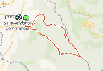

Length
10.2 km

Max alt
809 m

Uphill gradient
451 m
Km-Effort
16.2 km

Min alt
387 m

Downhill gradient
450 m
Boucle
Yes
Creation date :
2024-02-28 13:36:30.569
Updated on :
2024-02-28 16:45:09.961
3h06
Difficulty : Difficult

FREE GPS app for hiking
 SityTrail
IGN / Geographical institutes
SityTrail Plus
The world is yours!
About
Trail Walking of 10.2 km to be discovered at Auvergne-Rhône-Alpes, Drôme, Saint-Vincent-la-Commanderie. This trail is proposed by verozerr.
Positioning
Country:
France
Region :
Auvergne-Rhône-Alpes
Department/Province :
Drôme
Municipality :
Saint-Vincent-la-Commanderie
Location:
Unknown
Start:(Dec)
Start:(UTM)
667244 ; 4978366 (31T) N.
Comments