


Saint-Étienne-de-Chigny - le Vieux Bourg - Luynes - 15.8km 285m 3h30 - 2024 02 28

Orcal37
User GUIDE
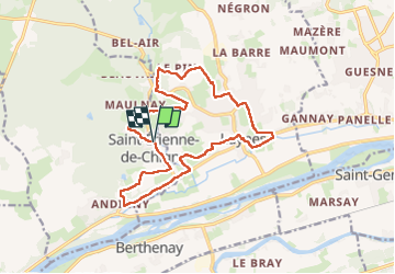

Length
15.8 km

Max alt
97 m

Uphill gradient
284 m
Km-Effort
19.6 km

Min alt
43 m

Downhill gradient
285 m
Boucle
Yes
Creation date :
2024-02-28 13:24:15.382
Updated on :
2024-02-29 15:00:09.124
3h30
Difficulty : Medium

FREE GPS app for hiking
 SityTrail
IGN / Geographical institutes
SityTrail Plus
The world is yours!
About
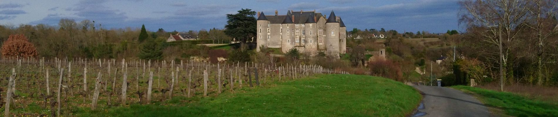
Trail Walking of 15.8 km to be discovered at Centre-Loire Valley, Indre-et-Loire, Saint-Étienne-de-Chigny. This trail is proposed by Orcal37.
Description
Saint-Étienne-de-Chigny - le Vieux Bourg - Luynes - 15.8km 285m 3h30 - 2024 02 28
Photos


Positioning
Country:
France
Region :
Centre-Loire Valley
Department/Province :
Indre-et-Loire
Municipality :
Saint-Étienne-de-Chigny
Location:
Unknown
Start:(Dec)
Start:(UTM)
313320 ; 5250853 (31T) N.
Comments